• Nacimiento Refinancing moved forward on August 18, 2026, when the San Luis Obispo City Council approved the city’s participation in the 2026 refunding of the remaining 2015A bonds tied to the Nacimiento Water Project. The council action, as described in the city’s official meeting recap, directed staff to proceed with refinancing steps while also setting a clear stop point: the process was to pause or end if expected savings dropped below the city’s minimum threshold of 3% net present value. The same recap estimated $3.6 million in net present value savings across all participating agencies and about $175,000 in expected annual gross debt-related savings for the City of San Luis Obispo, according to the city council recap.

    What The Nacimiento Refinancing Vote Changed

    Nacimiento Refinancing Terms Before The City

    The council’s August 18 action did not report a finished bond closing in the public recap. It authorized the city’s participation and gave staff direction to complete the needed steps if the savings test continued to be met. That distinction matters for residents following local utility costs, because an authorization vote is a major step but not the same as a final public notice that a refinancing transaction has closed.

    The Nacimiento Refinancing proposal centered on refunding remaining 2015A bonds. In public finance terms, refunding can replace older debt with new debt when market conditions and bond terms create savings. The city’s stated safeguard was the 3% net present value minimum. If the projected savings fell below that level, staff were directed to pause or stop. That condition gave the city a financial checkpoint rather than an open-ended instruction to proceed at any price.

    Why The Savings Estimate Matters Locally

    For San Luis Obispo residents, the public value of the vote lies in the numbers the council placed into the record. The estimate of $175,000 in annual gross debt-related savings for the city does not, by itself, describe a direct rate change or a new water bill amount. It does show that elected officials were considering debt service costs tied to a major regional water supply project. The larger $3.6 million net present value savings estimate applied across all participating agencies, not just the city.

    Local infrastructure finance often moves through council agendas without the public attention given to road closures or construction work. Yet bond costs can shape long-term utility budgets. The refinancing decision sits alongside other civic infrastructure finance items in San Luis Obispo, including our recent Prado Road Interchange grant status report, where public funding steps also affected the timing of a local project.

    Why The Pipeline Still Matters For SLO

    Project Scale And Public Investment

    The Nacimiento Water Project is not a small local line item. The original project built a 45-mile pipeline from Lake Nacimiento to San Luis Obispo County. County Public Works describes the project cost at $176 million and lists the start of operations as January 7, 2011, on its Nacimiento Water Project page. Those details explain why debt refinancing continues to matter more than a decade after water first moved through the system.

    The pipeline is part of a regional water strategy, and its financing has a long public tail. The August 18 council action was not about approving a new pipeline or changing the physical route. It was about debt tied to an existing project that still supports local water planning. For residents, that means the public discussion is less visible than a construction zone but still linked to the infrastructure that serves daily water needs.

    Debt Decisions And Public Accountability

    Large capital projects often leave cities and counties with repayment schedules that last for many years. That is why public meetings, staff reports, and council recaps are key tools for accountability. In this case, the city’s public record gave residents three points to track: the projected savings, the annual city benefit estimate, and the minimum savings threshold that staff had to preserve before moving forward.

    The Nacimiento Refinancing vote also showed how regional projects can require local decisions from more than one public agency. The city’s recap referred to savings across participating agencies. The available city record did not provide a full agency-by-agency breakdown in the recap, so residents seeking that level of detail would need to follow future agendas, bond documents, or meeting materials from the agencies involved.

    What Residents Can Track Next

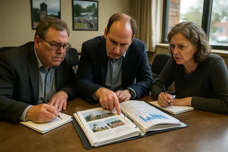
    Resident reviewing public meeting documents at a table

    Public Records To Watch

    The next civic step is document-based. Residents can review future San Luis Obispo City Council agendas, staff reports, and meeting recaps for any notice that the bond refunding closed, changed, paused, or failed to meet the required savings threshold. Because the August 18 source described approval to participate rather than a final closing, it would be premature to describe the financing as complete based only on that recap.

    Residents who follow chamber and civic coverage in other communities, especially within our publisher network, can visit Richland Chamber for business-community updates. For San Luis Obispo readers, the most relevant records remain the official city and county postings tied to water project finance, utility budgeting, and public works.

    • Check whether later agendas report final bond sale terms or closing dates.
    • Compare any final savings figure with the 3% net present value minimum set by the city.
    • Watch for budget documents that explain how annual debt-related savings are recorded.
    • Review county public works materials for project background and infrastructure status.

    Questions For Ratepayers And Council Watchers

    Several public questions remain fair to ask without assuming facts not yet in the record. Did the transaction close after the August 18 authorization? If it did, what were the final savings and repayment terms? If market conditions changed, did staff pause or stop the work as directed? The council’s condition gives residents a clear benchmark for evaluating later updates.

    Residents may also want to ask how any debt-related savings appear in city financial reporting. A gross annual savings estimate is useful, but budget treatment determines how that number shows up in public accounts. That does not mean the refinancing automatically changes a customer’s bill. It means the public can ask city staff to explain where the savings are booked and how they affect long-term water fund planning.

    Nacimiento Refinancing And Local Water Finance

    A Civic Finance Issue With Daily Reach

    Nacimiento Refinancing is a civic finance issue because it ties elected oversight to water infrastructure that residents rely on every day. The August 18, 2026 vote placed the City of San Luis Obispo on record in support of participating in the 2026 refunding, but with a savings requirement that limited staff authority if financial conditions weakened. That is the central public change from the meeting.

    The most accurate reading today is that the city approved participation and completion steps, subject to the stated savings floor. The public record cited here does not establish that the refinancing had closed by September 20, 2026. For residents, the responsible next step is to follow official meeting records and bond updates rather than assume the final outcome. The Nacimiento Water Project remains a major regional water investment, and its financing will continue to deserve clear public reporting as new documents are posted.

  • The horizontal levee pilot project at Harbor Marsh in the Palo Alto Baylands has moved from construction to evaluation, after the City of Palo Alto marked completion on September 10, 2026, with a ribbon-cutting and community trail walk, according to the city’s project event notice. The change matters locally because the site sits next to the Regional Water Quality Control Plant and Byxbee Park, linking wastewater reuse, shoreline protection, habitat restoration and public access in one small but closely watched Baylands project.

    What The Horizontal Levee Changed

    Horizontal Levee Facts For Residents

    The project is a 500-foot-long, gently sloped shoreline feature on Harbor Marsh. It covers about 0.7 acres and uses treated effluent from the regional plant to irrigate native plants on the levee slope. Construction began on September 8, 2025, and the city reported an estimated project cost of about $4.6 million in its completion announcement, shared through the City of Palo Alto notice.

    The horizontal levee is not being presented by the city as a finished answer to every Baylands flood or habitat question. It is a pilot project, which means its civic value depends on what monitoring shows after construction. The official research notes identify several measures that will be tracked, including soil buildup on the slope, vegetation succession, habitat suitability and comparisons with traditional levees.

    Where The Project Sits

    The location is important for residents who use the Baylands trails and for agencies watching how shorelines respond to sea level rise. Harbor Marsh is next to the Regional Water Quality Control Plant and Byxbee Park, placing the pilot near both public infrastructure and public open space. Treated water was first sent to the site for testing and startup in 2026, with the research notes identifying August 20, 2026, as the initial flow date and September 8, 2026, as a testing/startup milestone.

    The regional plant handles 20 million gallons per day of sewage from about 236,000 residents and businesses, according to the research provided for this report. At this site, treated effluent is reused to support native vegetation on the slope. That connection gives the project a practical civic purpose: it tests whether infrastructure already serving the region can also support Baylands habitat goals.

    How The Project Supports Baylands Ecology

    Native Planting And Habitat Goals

    More than 2,000 native plants representing 35 species were planted as part of the pilot, with seeds from hundreds of native plants also spread. The habitat targets include transitional marsh, wet meadow, riparian scrub and upland habitats. These zones are described in the research as part of an ecotone, the transition between freshwater marshes, wet meadows, upland scrub and tidal marsh.

    This horizontal levee was built to restore a kind of transition zone that has become rare because of development. For Palo Alto residents, the ecological importance is not just the number of plants installed. It is the attempt to reconnect habitat types that sit between the Bay edge and drier upland areas. Those transition zones can provide room for wildlife during high tides while also allowing plant communities to establish across a slope rather than along a hard edge.

    Wildlife Named In The Project Goals

    The research notes identify two endangered species expected to benefit: the salt marsh harvest mouse and the California Ridgway’s rail. The project is intended to provide habitat, foraging areas, nesting areas and refuge from high tides. Those benefits have not yet been reported as measured outcomes in the research provided. They are goals that monitoring is expected to test over time.

    For local ecology, that distinction matters. A completed construction project is different from a proven ecological outcome. As of September 19, 2026, the supported facts show that the site has been built, planted and connected to treated-water irrigation. The next public question is how well the plants establish, how wildlife uses the site and whether the slope performs as intended when compared with standard levee designs.

    Monitoring, Public Access And Civic Follow-Up

    Baylands trail beside restored shoreline habitat in Palo Alto

    Research Still To Be Reported

    Because the horizontal levee is a pilot, the monitoring phase is central. The research notes name USGS, CSU Channel Islands, UC Davis and local nonprofits as participating in ecological monitoring and research. The work is expected to look at soil buildup related to sea level rise, plant succession, habitat suitability and how the design compares with more traditional levees.

    Those monitoring topics should be useful to Palo Alto residents and regional agencies for a simple reason: they connect environmental goals with public works decisions. If the site shows that treated-water irrigation and native planting can help build habitat and shoreline resilience, the findings could inform future local or regional projects. If the results are mixed, that information will also matter because it can guide design changes before similar projects are expanded elsewhere.

    What Residents Can Watch Next

    The city’s September 10, 2026, completion event included a community trail walk, tying the project to public awareness as well as agency work. Residents who use Byxbee Park and nearby Baylands trails may notice the site as part of the shoreline setting, but the research provided does not include new trail rules, access changes or operating hours tied to the pilot. Any future public access changes should be checked through City of Palo Alto notices.

    • Watch for city updates on plant establishment and habitat monitoring.
    • Look for future reports on treated-water irrigation performance at the site.
    • Track whether monitoring compares the pilot’s shoreline function with traditional levees.
    • Review public notices before assuming any change in Baylands trail access.

    For readers who are interested in public infrastructure projects across the community, One United Michigan features related coverage within the same network. In Palo Alto, the key civic step is to keep the project in public view after the ribbon-cutting, since the ecological findings will take time and should be tied to clear updates from the city or partner researchers.

    Palo Alto Horizontal Levee Pilot Project

    Why The Completion Date Matters

    The September 10, 2026, completion date closes the construction phase and opens the public evaluation phase. The city has described the project as the Bay Area’s first horizontal, or “living,” levee using treated wastewater to irrigate native plants along a gently sloping shoreline facing the Bay. That first-of-its-kind status in the region makes the local monitoring especially relevant for nearby communities with shoreline infrastructure, wastewater facilities and habitat concerns.

    The horizontal levee gives Palo Alto a defined test site rather than only a concept. It brings together a 500-foot shoreline slope, native planting, treated effluent reuse and habitat goals for endangered species in one place. The public record now needs to show how those parts perform through monitoring, especially during high tides, plant establishment and longer-term soil development.

    What Is Known And What Is Not Yet Known

    What is known is specific: construction began on September 8, 2025; the project cost is about $4.6 million; treated water began flowing for startup in 2026; and the city marked completion on September 10, 2026. The research also supports the planting totals, habitat types and wildlife goals listed above.

    What is not yet known from the provided public materials is just as important for civic reporting. The research does not include measured survival rates for the native plants, confirmed wildlife use after completion, quantified water quality outcomes or a formal comparison showing how the site has performed against a traditional levee. Those findings should come from future monitoring. Until then, Palo Alto’s completed pilot stands as a public infrastructure and ecology test whose value will depend on transparent reporting and continued local attention.

  • Fairfax Crossing Guards became a visible school safety concern when Fairfax County Public Schools opened the 2026-27 school year on Monday, August 24, 2026, after county budget action removed crossing guards from public high school locations. FFXnow reported the first day of school and the related operational changes, including fewer crossing guards, as students returned to class in its August 24 report. The change affected families, students, school staff, police staffing plans, and county budget decisions within the first weeks of the academic year.

    What Changed For Fairfax Crossing Guards

    Why Fairfax Crossing Guards Became A Budget Issue

    The crossing guard change came through the adopted Fiscal Year 2027 budget, which the Fairfax County Board of Supervisors approved on May 5, 2026. The budget eliminated all crossing guards assigned to public high schools. According to the county reduction materials, the action cut 13 full-time positions and $1.89 million from the Fairfax County Police Department budget, while leaving elementary and middle school crossings covered through a different staffing approach in the county reduction package.

    The county materials described the change as applying to high school crossings, not to elementary or middle school crossings. Those younger-grade crossings retained guard coverage, with vacancies to be filled through contractors rather than uniformed officers. That distinction matters for residents because high school students often walk farther, cross larger roads, or arrive by a mix of walking, driving, bus, and kiss-and-ride traffic patterns.

    The affected high schools identified in the research record included Annandale, Centreville, Chantilly, Edison, McLean, Oakton, South County, South Lakes, West Potomac, and West Springfield. The budget action did not mean every student at those campuses walked across the same type of intersection. It did mean county officials had removed a long-standing public safety presence from high school arrival and dismissal points before the first bell on August 24.

    The First Weeks Of School

    Residents’ concerns centered on daily conditions at campus entrances and nearby intersections. The research record described complaints about traffic confusion, difficult crossings, and tense arrival or dismissal periods, including concerns around South Lakes High School and the kiss-and-ride entrance off South Lakes Drive. Those concerns were sharpened on September 1, 2026, when a 16-year-old student walking to South Lakes High School was hit by a car around 7:54 a.m. and sustained minor injuries.

    After that incident and the public response, the county reinstated uniformed crossing guards at Centreville, Edison, South Lakes, West Potomac, and West Springfield high schools starting September 1, 2026, according to the research materials provided for this report. Two weeks later, on September 15, 2026, the Board of Supervisors approved a carryover budget package restoring 11 crossing guard positions at 10 high schools. The annual amount listed for that restoration was $707,908.

    School Arrival Safety Concerns

    What Residents Said The Cut Changed

    The immediate concern was not only the absence of a uniformed employee at a crosswalk. Families and school representatives questioned how the decision matched the lived conditions around large high schools where students arrive by foot, bus, student-driven vehicles, parent drop-off, and staff traffic at the same time. Even where a crossing may look manageable during a site review, morning arrival can compress hundreds of movements into a short window.

    Fairfax Crossing Guards had served as traffic-control points and as a visible cue for drivers that students were entering the roadway. When that presence was removed from high school sites, some parents and elected representatives called for clearer information about the data behind the decision. The research record says Hunter Mill District School Board Representative Melanie Meren and others sought more transparency about the traffic and crash data used to justify the budget cut.

    For residents, the civic question became direct: if the county relied on traffic and crash data, what did that data show at each school, and how often would it be reviewed after the start of classes? A countywide cut can be easier to write into a budget than to apply at individual intersections. South Lakes Drive, West Potomac’s nearby road network, and other campus approaches may not carry the same risk profile, sight lines, traffic speed, or student walking patterns.

    Why High School Crossings Are Different

    High school students are older than elementary and middle school students, but that does not remove safety questions. Many high schools sit along major commuter routes. Some students walk in low-light morning conditions later in the year. Others cross near turning vehicles, buses, and student drivers who are still gaining experience behind the wheel.

    That is why several residents treated the budget cut as both a school issue and a transportation issue. A crossing guard decision touches police staffing, school operations, pedestrian planning, and public trust. It also affects how quickly a campus can respond when traffic patterns do not match expectations. The September 1 incident at South Lakes High School gave families a concrete example of why they wanted the county to revisit the change quickly.

    How The County Described The Cut

    County budget papers on a public meeting table

    Budget Savings And Staffing Choices

    The county’s budget documents framed the high school crossing guard removal as a reduction within the police department budget. The stated savings were tied to full-time positions and operating costs. Elementary and middle school crossing posts were treated separately, with contractor staffing used for vacancies rather than uniformed officer coverage.

    That staffing distinction matters because residents may see a guard in one school zone and not another, even within the same community. A family with children in both middle school and high school could see crossing coverage maintained at one campus while removed at another. That uneven experience helped make the high school change more visible during the opening days of the school year.

    The county decision was described in the research record as data-driven, based on traffic and crash data and site reviews by the Fairfax County Police Department and Fairfax County Public Schools. Residents asking for more transparency were not only challenging the savings figure. They were asking how local road conditions, student walking routes, and prior crash patterns were weighed before guards were removed.

    What The September Vote Signaled

    The September 15 carryover action showed that the county had reopened the question after the school year began. Restoring 11 positions at 10 high schools did not erase the budget process that led to the removal, but it did signal that resident concerns and early school-year conditions had reached county decision-makers.

    For Fairfax Crossing Guards, the sequence of events is now part of the public record: a May budget approval, an August school opening without high school guards, a September 1 student injury at South Lakes High School, partial reinstatement at five high schools that same day, and a September 15 vote to restore 11 positions. That timeline gives residents a clear basis for future questions at budget hearings and school safety discussions.

    Fairfax Crossing Guards And The Next Public Question

    The next civic question is how Fairfax County will evaluate crossing guard needs before the next school year and during future budget work. Residents who were concerned by the August 24 start can ask for school-by-school data, site review criteria, and a plain explanation of how high school pedestrian crossings are ranked for staffing.

    Fairfax County families may also want to watch whether restored positions are filled quickly, where guards are assigned, and whether campuses without guards receive other safety measures. Those could include clearer traffic patterns, adjusted drop-off directions, school communications to drivers, or public works review of crosswalks and signal timing. Any such step would need to come from the appropriate county, school, police, or transportation office.

    For those looking to gain insight into regional public-service decisions beyond Fairfax County, explore more through ITPR. The Fairfax case illustrates how changes in a budget line can manifest as immediate concerns that impact students and parents at the curb. The Fairfax Crossing Guards issue now stands as a visible school safety debate, with active engagement from residents, meetings, and official documents to track.

  • Wake School Repairs moved from urgent summer construction to a public cost-and-timeline review on September 15, 2026, when the Wake County Board of Education met in Raleigh and addressed facility items tied to emergency structural work. The regular meeting was scheduled for 5:30 p.m. and included agenda items on construction contracts and capital building projects, according to the NC GovWatch meeting record. For families at the affected elementary schools, the key change was not a new closure notice, but a clearer public record of what the district spent and what questions remain.

    Wake School Repairs Timeline Reviewed September 15

    Wake School Repairs Moved Into Board Review

    The September 15 board activity followed emergency structural repairs at three Wake County elementary schools: Creech Road Elementary in Garner, Davis Drive Elementary in Cary, and Durant Road Elementary in Raleigh. The repair work drew public attention because the schools were identified as having similar building issues after inspections. The three schools were built in the early 1990s and shared a prototype design, according to the research record for this report.

    At the September 15 work session, the board acknowledged that the final cost of emergency repairs at the three schools reached $6.4 million, higher than the original $5.6 million estimate, as WRAL reported on the final repair cost. That cost update matters for parents, staff, taxpayers and county leaders because emergency school repairs can shift capital planning decisions well beyond a single campus.

    The timeline issue is also now different than it appeared before September 15. The meeting described in earlier public discussion has already occurred as of September 18, 2026. That means residents seeking answers should treat the September 15 meeting and work session as the latest verified public checkpoint, not as an event still ahead on the calendar. Future board action may follow, but the research available for this report does not verify a new dated vote or hearing on these same repairs.

    What Families Could Verify After The Meeting

    Families affected by Wake School Repairs can now point to several verified details. The district placed construction contracts and capital building projects on the September 15 regular meeting agenda. The board also received a final cost figure in the work session. The record supplied for this report does not include a new student relocation order after that date, nor does it verify a fresh delay for any of the three schools.

    That distinction is useful for civic readers. A board agenda can show what leaders discussed or considered, while a final adopted action may appear later in minutes, contract documents or follow-up reports. Residents who track school construction decisions in other nearby counties may recognize the same need to separate posted meeting status from verified action; a related local example is the recent Alamance school facilities meeting status report.

    Costs And Scope At The Three Schools

    Cost Changes By Campus

    The largest reported cost among the three campuses was at Creech Road Elementary. The research record states that Creech Road reached roughly $2.6 million, with added foundation repairs contributing to the increase beyond original estimates. Davis Drive Elementary was reported at approximately $1.8 million, while Durant Road Elementary was reported at approximately $2.0 million.

    Those figures help explain why Wake School Repairs became a systemwide budget concern rather than a routine maintenance item. Emergency work at one campus can be difficult enough for a school district to schedule around classroom use, staff access, food service and transportation. Emergency work across three campuses at the same time can place pressure on facilities staff, contractors and board oversight.

    The known structural concerns were serious enough to require immediate attention. At Creech Road Elementary, inspections identified problems in 12 classrooms and five other spaces, including the front office, cafeteria, kitchen, stage and loading dock, according to the research record. Other repair concerns included missing grout, missing connectors in wall and beam connections, and insufficient reinforcing steel in critical wall areas, based on wall x-ray findings included in the supplied research.

    Why Prototype Design Matters

    The shared prototype design is a key fact for residents to understand, but it should be treated carefully. A shared design does not by itself prove that every similar school has the same defect, and the research for this article does not verify a wider closure list beyond Creech Road, Davis Drive and Durant Road elementary schools. It does, however, explain why district staff and board members would pay close attention to repeated conditions across buildings from the same era.

    For taxpayers, the prototype issue raises practical questions. If similar construction details were used across campuses, the district may need clear documentation showing which buildings were inspected, what methods were used, and whether future capital projects should include targeted structural review. The research record says the district is still investigating whether legal action can be pursued over earlier construction defects, including whether buildings deviated from approved blueprints.

    Capital Planning Questions For Families

    Facilities staff reviewing school maintenance plans at a table

    Deferred Maintenance Pressure

    The emergency repair costs arrived against a larger facilities backdrop. The research record states that Wake County Public School System faces about $800 million in deferred maintenance systemwide, with roughly a quarter tied to HVAC systems. That broader maintenance burden gives the September 15 cost update more weight, because the school board must balance emergency fixes with long-term needs across nearly 200 schools.

    During a September 8, 2026 facilities committee meeting, the district’s new Chief of Facilities and Operations flagged that the system receives 25 to 50 critical work orders per day across nearly 200 schools. The research record says about 80% to 90% of those critical work orders are resolved within one day. Those figures show that the district is handling daily facility demands while also responding to unusually expensive structural repairs.

    Wake School Repairs therefore sit at the intersection of safety, capital spending and public trust. Parents want to know whether classrooms are ready for instruction. Staff members need to know whether offices, cafeterias and other support spaces are reliable. County residents need to know whether repair spending will affect future bond planning, maintenance schedules or other school construction priorities.

    Documents Residents Should Watch

    Residents who want to stay engaged should watch for posted meeting minutes, future facilities committee materials, capital project updates and any legal review that the district makes public. The September 15 meeting record confirms that board-level discussion occurred, but the next civic step depends on what the district posts after staff reports, contract updates or legal findings are complete.

    Public participation is strongest when residents use verified documents rather than rumors. Parents can compare board agendas with minutes once minutes are approved. Community members can review contract items to see whether costs are final, amended or tied to broader capital plans. Civic groups can also monitor how emergency repairs fit beside HVAC work, deferred maintenance and routine critical work orders.

    For readers following public-agency coverage in partner communities, the same document-first approach can be found through the Houston LWS Forum, part of a related civic information network.

    Wake School Repairs And Public Accountability

    What Is Known And What Is Not Yet Verified

    As of September 18, 2026, the verified record shows that the Wake County Board of Education met on September 15, considered facility-related agenda items, and received a final emergency repair cost of $6.4 million for Creech Road, Davis Drive and Durant Road elementary schools. The cost exceeded the earlier $5.6 million estimate. Creech Road carried the largest reported cost among the three schools.

    What is not yet verified in the research for this report is just as important. There is no supplied official record confirming a new dated board vote after September 15 on legal action, additional closures or a new repair schedule for these same three campuses. The district’s investigation into potential legal claims remains an open matter in the research notes, and any final decision should be judged by official board action or district notice.

    The civic takeaway is direct: Wake School Repairs are no longer just an emergency construction story. They are now a public accountability issue involving final costs, facility oversight, documentation and future capital planning. Families in Garner, Cary and Raleigh have reason to keep watching the board’s posted records, especially if new reports connect these repairs to deferred maintenance, legal review or future school construction decisions.

  • The utility reserve policy debate in Palo Alto has moved forward, but the specific claim that the Palo Alto City Council will review a final narrowed proposal on September 28, 2026, is not confirmed in the research available as of September 17, 2026. Verified reporting shows that the Utilities Advisory Commission narrowed its recommendation on September 2, 2026, and that the matter is expected to move first to the Finance Committee and then to the City Council in January 2027, not on a verified September 28 agenda.

    What Changed In The Utility Reserve Policy Debate

    Why The Utility Reserve Policy Was Narrowed

    On September 2, 2026, Palo Alto’s Utilities Advisory Commission voted 5-2 to revise its recommendation to the City Council by removing a proposed rate-stabilization reserve while keeping a capital-improvement reserve target, according to Palo Alto Civic. That vote matters for residents because utility reserve decisions can affect how the city prepares for infrastructure work, emergencies, and possible rate pressure.

    The removed rate-stabilization reserve had been proposed at a target equal to 10% of operating expenses over five years. As originally drafted, that piece was estimated to add about 0.5% annually to gas rates and less than 1 percentage point for electric and water rates. By dropping that part of the package, the commission reduced the near-term scope of what it planned to send forward.

    That change matters because a utility reserve policy can shape how much cash the city sets aside before projects or emergencies occur. For households and businesses, the policy question is not only whether reserves are prudent, but also how fast the city should build them and which customer groups would carry the cost through rates.

    Capital Reserve Timeline

    The recommendation retained a target for a capital-improvement reserve. The revised plan ties the target to one year’s worth of average cash-funded, non-grant-funded capital improvement budgets and sets a five-year timeline. In plain terms, the narrowed proposal focuses on capital needs rather than a broader cushion to stabilize rates.

    The commission also asked for more work on related reserve categories, including supply-side and wastewater reserves. Verified reporting says the goal is to develop a reserve management policy for City Council consideration by June 2027, aligned with rates for fiscal year 2028. That means the September 2 vote did not end the reserve discussion. It narrowed one recommendation and left other parts for future staff and commission work.

    What Is Confirmed About September 28

    No Verified Council Agenda In Research

    The available research does not confirm that the Palo Alto City Council is scheduled to review a final narrowed reserve proposal on September 28, 2026. Because civic meeting notices can change, the most careful reading is that the September 28 date remains unverified unless it appears on an official council agenda or another confirmed city notice.

    That distinction is significant for residents who follow city utility decisions. A commission vote is a recommendation step. A City Council review is a separate public action that normally carries its own agenda posting, staff report, public comment opportunity, and meeting record. Without a verified agenda item, it would be inaccurate to tell residents that a final council review is set for September 28.

    January 2027 Path Cited

    The verified timeline points instead to a later path. The narrowed recommendation is expected to go to the Finance Committee and then the City Council for consideration in January 2027. That does not prevent the city from discussing related utility matters before then, but it does mean the specific claim about a September 28 final review is not supported by the research provided.

    Residents tracking the issue should watch for two separate items: the narrowed capital reserve recommendation and the broader reserve management policy work that is expected by June 2027. The first is more immediate. The second could bring supply-side and wastewater reserve questions back into public discussion before rates are set for fiscal year 2028.

    Ratepayer Stakes And Prior Council Action

    Residential utility meter outside a Palo Alto home

    June Rate Increase Context

    The reserve debate follows a major utility rate decision earlier in 2026. The Palo Alto City Council approved an 8% utility rate increase on June 15, 2026, projected to bring in $28.6 million for reserve building and infrastructure, the Palo Alto Daily Post reported. The reported increases were 16% for wastewater, 9% for gas, 8% for water, 4.5% for electric, and 3% for refuse and trash.

    For residents, those figures frame why the reserve vote is more than an accounting issue. Utility customers already faced approved rate increases in 2026, and reserve targets can influence future rate planning. A narrower proposal may reduce one source of added pressure, but capital work still requires funding, especially when projects are paid with cash rather than grants.

    Wildfire And Backup Power Items

    The September 2 commission meeting also included a wildfire-related action. The Utilities Advisory Commission voted 7-0 to submit the city’s updated Utility Wildfire Mitigation Plan to the California Wildfire Safety Advisory Board by October 2, 2026. That separate vote connects utility planning to public safety, outage preparation, and infrastructure reliability.

    Staff analysis discussed long-duration outage risk, including an estimate that a 4-megawatt, four-hour battery could power about 300 single-family homes for 24 hours at a cost of $5.4 million, with a possible drop to about $2.4 million by 2035. Complementary solar backup capacity might require 20 acres of land and cost $12 million to $15 million. Readers following that related commission action can review our coverage of the Palo Alto wildfire planning date.

    The overlap between reserves, rates, capital projects, and wildfire preparation gives the public several points to follow. A reserve target can influence how fast the city can respond to infrastructure needs. A wildfire mitigation plan can influence spending priorities. A rate decision determines how those choices reach monthly bills.

    Palo Alto Reserve Policy Watch Points

    How Residents Can Track The Item

    Residents who want to follow the Utility Reserve Policy should look for official agenda language from the Palo Alto City Council and its Finance Committee before assuming a meeting date. The key civic question is whether the narrowed capital reserve target moves forward as written, changes again in committee, or returns to staff for more work before council review.

    Public comment may focus on several grounded questions:

    • Whether the five-year timeline for the capital-improvement reserve is affordable for ratepayers.
    • Whether removing the rate-stabilization reserve leaves the city with enough flexibility during cost changes.
    • How supply-side and wastewater reserves will be defined before the planned June 2027 policy work.
    • How reserve targets will appear in rates for fiscal year 2028.

    For now, the verified record shows a narrowed commission recommendation, an expected Finance Committee and City Council path in January 2027, and more reserve management work planned for June 2027. It does not show a confirmed final City Council review on September 28, 2026. Readers interested in related community developments might find valuable insights at Saint Joseph Detroit, which is a related site in the same network.

    A utility reserve policy is not a single-date issue for Palo Alto. It is a continuing public finance discussion tied to infrastructure, reliability, wildfire preparation, and future utility bills. The next verified step is to watch for posted Finance Committee and City Council materials that clearly identify the reserve item, the recommendation before members, and the public comment process.

  • Mid-September brings fresh data and shifting community schedules to the Trinity Peninsula. Local school districts are processing new state academic ratings, and civic groups prepare for major fall events. Trinity County local news provides business owners and parents with the exact information needed to respond to local educational changes and capitalize on upcoming community gatherings.

    Apple Springs ISD Receives New Accountability Ratings

    Public school performance directly affects the local housing market and regional workforce readiness. The state recently released the 2026 accountability results for local districts, highlighting mixed progress for Apple Springs Independent School District (ISD). The district held steady with an overall D rating, and individual campus performances moved in opposite directions.

    Analyzing these academic shifts allows district leaders to reallocate teaching resources and adjust classroom strategies for the current fall semester. Strong campus performance attracts new families to the area, which increases local property values and expands the consumer base for retail businesses. Parents and local real estate professionals can review the complete grading metrics and district guidelines through the official Texas Education Agency portal. Community involvement and targeted tutoring programs follow these public rating releases, giving local businesses a chance to sponsor academic initiatives.

    Groveton Prepares For Historic Fall Homecoming

    Schools focus on academic metrics and serve as the cultural anchor for East Texas communities. The Groveton Ex-Students Association, known as the “Old Indians,” is actively preparing for the 2026 Groveton Homecoming. Scheduled for Friday, October 16, and Saturday, October 17, 2026, this year marks a “BIG” homecoming cycle that will draw hundreds of alumni back to the county.

    The association is currently asking the community to submit nominees for the Groveton Hall of Fame. Large alumni events inject immediate capital into the local economy. Returning graduates book hotel rooms, purchase fuel, and fill local restaurant dining rooms.

    The table below outlines the primary economic benefits generated by the upcoming homecoming weekend:

    Event ComponentTarget AudienceDirect Local Impact
    Friday Night FootballAlumni and Regional FansDrives high-volume sales at local convenience stores.
    Hall of Fame BanquetPast Graduates and FamiliesMaximizes evening revenue for local caterers and venues.
    Saturday GatheringsVisiting FamiliesIncreases weekend traffic for Groveton retail shops.

    County Leaders Finalize Road Maintenance Plans

    As local traffic increases for fall events, county infrastructure requires constant attention. The Trinity County Commissioners Court recently reviewed regional road maintenance schedules following the adoption of the fiscal year 2027 budget. Commissioners focus on repairing farm-to-market roads and rural bridges to keep commercial freight moving safely.

    Maintaining clear transport routes allows local agricultural producers and timber companies to ship their products without costly delays. Safe roads protect the daily commute for school buses and local workers. Tracking the specific locations of upcoming bridge repairs and pavement upgrades helps regional delivery companies adjust their routing. Residents and commercial drivers can find real-time traffic updates and state highway maintenance alerts through the Texas Department of Transportation website.

    Trinity County

    Preparing For Fall Agricultural Seasons

    The shift in seasons signals the beginning of fall agricultural preparations. Local ranchers and property owners are updating their land management strategies as cooler weather approaches. Preparing pastures and securing heavy equipment reduces the risk of accidental fires during the dry autumn months. Following local burn bans and safe operational protocols protects commercial investments across the county. Staying informed on these local educational and civic updates keeps the Trinity County business community prepared for a busy fall season.

    Reviewing the Trinity County Texas Commissioners Court Regular Session shows exactly how local officials allocate public funding and debate infrastructure projects for the upcoming fiscal year.

  • As of September 14, 2026, the public record provided for this report does not confirm that the San Luis Obispo City Council will discuss Prado Road Interchange grant applications on September 21, 2026. What is confirmed is that early geotechnical work began on Sunday, September 13, 2026, bringing overnight ramp and shoulder closures near U.S. 101 and Prado Road. For residents, commuters, nearby businesses and city budget watchers, the immediate civic issue is separating verified project activity from an unconfirmed council date.

    Prado Road Interchange Grant Status

    What Is Confirmed About Prado Road Interchange

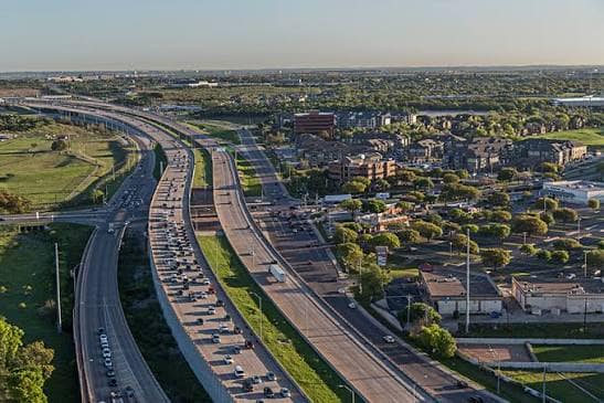
    Caltrans District 5 announced that overnight work tied to drilling for the project began on Sunday, September 13, 2026. The agency said the U.S. 101 northbound on-ramp at Prado Road would close overnight, with shoulder closures on southbound U.S. 101, from 8 p.m. to 5 a.m. through Friday, September 25, 2026. Caltrans described the work as support for design efforts and said the planned partial interchange includes northbound on- and off-ramps, plus an overpass connecting Prado Road with Madonna Road, according to the agency’s District 5 notice.

    That makes the week of September 13 a visible project marker, even though the work is preliminary and tied to design rather than full construction. The overnight hours also matter for people who use Prado Road to reach U.S. 101 after evening shifts, late events or airport-area travel. Caltrans’ stated closure window gives drivers a clear timeframe, but residents should treat traffic impacts as work-zone dependent during the September 13 through September 25 period.

    What Is Not Confirmed for September 21

    The research available for this report does not include a credible agenda, staff report or official notice confirming that Prado Road Interchange grant applications will be discussed by the San Luis Obispo City Council on September 21, 2026. That distinction is important for public participation. A possible meeting date is not the same as a posted agenda item, and residents should wait for official city meeting materials before assuming there will be a vote, direction to staff or public comment period tied to grants on that date.

    The confirmed civic thread is narrower but still significant: the city has previously taken steps connected to project design and grant pursuit, while Caltrans has started field work that supports design. If a grant item appears on a later council agenda, the key questions for residents will involve the grant source, local matching requirements, cost exposure and how any award would fit into the city’s long-range capital planning.

    Cost, Design, and Timeline

    Cost Estimate Rose in 2025

    The cost picture is central to the grant discussion. A March 4, 2025 report by the San Luis Obispo Tribune said the total estimated cost for the full project, including the overpass, roadway, ramps, design and administrative costs, had risen from about $97 million in 2023 to about $148 million as of that date. The same report said construction was estimated to begin in Fall 2029 after design, environmental review, right-of-way acquisition and utility relocations, as reported by the San Luis Obispo Tribune.

    Those figures help explain why outside funding remains a major civic issue. A project that approaches the $148 million estimate would place pressure on several public funding sources, including local development-related proceeds, regional transportation commitments, debt financing and competitive grants. The Prado Road Interchange is not simply a road design question; it is also a long-term public finance decision with consequences for future capital budgets.

    Design And Preconstruction Steps

    City Council records cited in the project research show that, on February 18, 2025, the council approved moving the project into the Plans, Specifications and Estimates stage by awarding a design contract to Consor. Those records also show the council appropriated $9,897,681 from San Luis Ranch bond proceeds to the project’s design and construction account. That action placed the project deeper into design work, but did not mean construction was ready to begin.

    The research also states that, on August 4, 2026, the council took action allowing staff to submit competitive grant applications to help offset project costs. That same action included review of design elements and approval of utility undergrounding and value-engineering measures aimed at cost savings. Without a confirmed September 21 agenda item, those prior actions remain the verified council steps available for public review.

    Travel Impacts and Local Access

    Overnight Ramp Closure Details

    For drivers, the most immediate change is the overnight closure pattern at Prado Road. The work affects the northbound on-ramp at Prado Road and southbound U.S. 101 shoulders during the 8 p.m. to 5 a.m. window through September 25, 2026. Because the closures are tied to drilling, not bridge construction, daytime travelers may see less disruption than overnight users. Still, people who depend on the ramp during late hours should plan routes with the closure window in mind.

    The location matters because Prado Road is a key east-west connector in southern San Luis Obispo. The planned overpass connection to Madonna Road would change how some local trips move across U.S. 101 once built. At this stage, however, the work remains part of early project preparation. Any claims about final traffic outcomes should be tied to official project documents and future construction plans.

    Why Local Access Questions Matter

    Residents often experience major transportation projects first through short-term closures, even when the long-term project timeline stretches for years. The September 2026 drilling work is one example. It is limited in scope, but it signals that the design process is active. It also gives residents a reason to follow council agendas, transportation agency updates and capital budget documents with closer attention.

    Local public works decisions often move across several agencies before residents see pavement, ramps or bridge columns. In this case, the research identifies partners including Caltrans, the City of San Luis Obispo, San Luis Obispo County and the San Luis Obispo Council of Governments. That shared role means questions about timing, grants and cost responsibility may appear in more than one public meeting venue.

    Public Funding Questions

    Residents reviewing budget papers during a public meeting

    Grant Applications And Local Match

    Because the city previously allowed staff to submit competitive grants, the next public funding discussion should be judged by the details of any specific application. Residents should look for whether a grant requires local matching funds, whether the city would need to commit money before an award, and whether the grant would pay for design, right-of-way, utilities or construction. Those categories are not interchangeable in capital planning.

    The research also notes that debt financing for the project appears in the city’s 10-Year Capital Improvement Program forecast in Fiscal Year 2029-30. That timing lines up with the reported Fall 2029 construction estimate, but forecasts can change as bids, grants and project requirements develop. Civic groups and business organizations tracking regional infrastructure can compare public works coverage across the same network through ITPR regional reporting.

    Questions Residents Can Ask

    If a Prado Road Interchange grant item is posted for any future council meeting, residents can review the staff report with a few practical questions in mind:

    • What agency would award the grant, and what deadline applies?
    • How much local funding would be required if the application succeeds?
    • Would the grant reduce debt needs or shift costs to a later budget year?
    • What project phase would the money cover?
    • How would the grant affect the reported Fall 2029 construction target?

    Those questions keep the discussion focused on public cost, schedule risk and decision points. They also help separate project support or opposition from the narrower task of evaluating whether a grant application is financially sound.

    Prado Road Interchange Civic Watch Points

    The most accurate status as of September 14, 2026 is this: field work has begun, overnight closures are scheduled through September 25, the project cost estimate has increased sharply since 2023, and the city has taken prior action connected to design and grant pursuit. A September 21, 2026 council discussion on Prado Road Interchange grant applications is not confirmed by the research provided for this report.

    Residents who want to weigh in should watch for a posted City Council agenda, staff report and any listed public comment instructions before treating a meeting date as official. For a project of this size, the key civic step is not rumor-tracking; it is reading the posted materials, checking the funding terms and asking how the decision affects local transportation access and future city budgets.

  • Palo Alto Plant Upgrades moved forward on August 10, 2026, when the Palo Alto City Council voted 7-0 to approve a revolving line of credit of up to $31 million with U.S. Bank National Association for interim improvements at the Regional Water Quality Control Plant. The action affects a core public works facility that serves Palo Alto and regional partner communities, and it gives city staff short-term borrowing capacity while longer-term financing for major plant work remains under review.

    Palo Alto Plant Upgrades Financing Action

    What The Council Approved

    The council approval authorized a revolving line of credit, not a one-time bond sale. Under the structure described in the council research, the facility has an initial five-year term, with the possibility of an extension of up to three more years. That structure gives the city access to funds as work proceeds, rather than requiring all proceeds to be drawn at once.

    The maximum credit amount is $31 million. The expected net proceeds were estimated at about $30.87 million, with a finance charge of about $127,000. Total payments through maturity were estimated at approximately $33.94 million, based on the financing assumptions included in the council materials. The research also listed a 3.416% true interest cost.

    How The Credit Line Is Expected To Work

    City materials described the line of credit as a bridge for interim needs tied to a larger capital program valued at more than $460 million. Draws may be taxable or tax-exempt, depending on project eligibility. The council research said tax-exempt draws under the then-current one-month SOFR rate were estimated at about 4.1%, while undrawn funds would carry a 0.25% fee.

    Palo Alto solicited proposals from 19 banks and received two proposals. Staff selected U.S. Bank based on the fee structure and the bank’s experience with water utilities, according to the supplied council research. Council materials anticipated an initial draw later in August 2026, primarily to cover closing costs associated with the financing. Because that expected draw date has passed as of September 9, 2026, residents seeking confirmation of any completed draw should check the city’s posted finance and council records.

    Plant Work Tied To A Larger Capital Program

    Capital Projects At The Regional Facility

    The Regional Water Quality Control Plant is not a single-project facility. Palo Alto’s Public Works Department describes capital improvement projects at the plant that include upgrades to aging equipment, rehabilitation work, and new treatment technologies. As of the city’s public project page, those capital improvement projects total about $397.2 million, according to the city’s Capital Improvement Projects page.

    That public works total and the council research figure of more than $460 million are not presented here as the same number. They appear in different project and financing contexts. For ratepayers and partner agencies, that distinction matters because the city’s financial plan may include separate project phases, planning costs, interim borrowing, and possible long-term debt tools.

    Engineering Planning Extended Through 2027

    The same council action package included a related contract step for planning work. The council increased the Carollo Engineers contract for the plant’s Long Range Facilities Plan Update by $551,755, bringing the total contract amount to $3.29 million. The contract was also extended through December 2027.

    That extension signals that the city expects planning, design coordination, and project sequencing to continue well beyond the August 2026 credit approval. Palo Alto Plant Upgrades will depend not only on borrowing authority, but also on the city’s ability to match project timing with regulatory needs, plant operations, and available financing.

    Why The Upgrade Decision Matters Locally

    Public works facility near low industrial buildings and service roads

    Public Works Impacts For Residents

    For residents, the Regional Water Quality Control Plant is basic civic infrastructure: it treats wastewater, supports environmental compliance, and helps protect public health. The August 10 vote did not approve a new neighborhood program or a one-day public event. It approved financing capacity for work at a regional utility facility that affects daily service reliability.

    The city is also advancing the Secondary Treatment Upgrades Project. The U.S. Environmental Protection Agency says the project has been invited for a $66 million Water Infrastructure Finance and Innovation Act loan to support compliance with new regulations and future capacity needs, according to the EPA’s WIFIA project profile.

    The research provided for this report did not include a newly approved utility rate change tied directly to the August 10 line of credit. That means any claim about a specific household bill increase would go beyond the available record. Residents should rely on future city budget, utility rate, and council agenda materials for any rate-related decisions.

    What Residents Can Watch Next

    Palo Alto Plant Upgrades now enter a public accountability phase shaped by borrowing activity, contract management, project schedules, and public reporting. The line of credit gives the city flexibility, but each draw, project award, and future financing decision will carry public cost implications.

    • Check future Palo Alto City Council agendas for draw activity, bond actions, or utility rate discussions tied to the plant.
    • Review Public Works updates for changes to capital project cost estimates, timelines, and construction sequencing.
    • Follow contract amendments connected to the Long Range Facilities Plan Update through December 2027.
    • Watch for EPA WIFIA loan milestones related to the Secondary Treatment Upgrades Project.

    If you’re interested in broader coverage of similar civic infrastructure topics, the Houston LWS Forum offers reports and insights from across the regional community network.

    Palo Alto Plant Upgrades And Public Accountability

    Financing Details Residents Can Track

    The clearest change from the August 10 council action is financial: Palo Alto has authority to use up to $31 million in revolving credit for interim plant work. The decision was unanimous, with a 7-0 vote, which indicates council agreement on the need for interim financing even as the city continues to evaluate longer-term options.

    Several figures deserve continued public attention. The estimated net proceeds were about $30.87 million. The finance charge was estimated at about $127,000. Total payments through maturity were estimated at about $33.94 million. The line may run for five years, with a possible extension of up to three years. Those terms give residents specific markers to compare against future staff reports and audited financial documents.

    Palo Alto Plant Upgrades remain a long-running public works issue, not a single meeting item. The council’s August 10 action set up interim borrowing capacity, extended planning work, and kept a major treatment plant program moving. The next civic test will be whether future council reports clearly show how much is drawn, which projects receive funding, how costs change, and what choices remain for long-term financing.

  • The Inglewood Downtown Rebuild is moving from council approval toward scheduled construction, with work set to begin in mid-November 2026 at the Market and Florence site. On August 25, 2026, the Inglewood City Council approved a public-private partnership tied to the Inglewood Transit Connector Phase 1 Mobility Project, according to the official ITC announcement. The first phase is expected to affect people who travel through Historic Downtown, use the Metro K Line station, own or work at nearby businesses, or attend events in the city’s sports and entertainment district.

    The project is framed by the city as both a downtown rebuild and a mobility program. Phase 1 centers on new mobility hubs, a pedestrian bridge over Florence Avenue, streetscape work, and event-day bus and shuttle improvements. If you’re interested in following related community efforts, County Watchers provides insights into similar projects across various locales. In Inglewood, the next step is practical: residents and businesses should watch for construction notices, traffic changes, and block-by-block schedules as the November start date approaches.

    What The Inglewood Downtown Rebuild Approved

    Inglewood Downtown Rebuild Contract And Funding

    The City Council action approved a design-build-finance-operate-maintain contract with Elevate Inglewood Development Corporation. The research record identifies that consortium as led by Plenary Americas, with Swinerton serving as design-builder and Walter P. Moore named as architect of record. The structure places design, construction, financing, operations, and maintenance under one partnership framework for Phase 1.

    The approved Phase 1 design and construction budget is $261 million. The project materials state that funding comes entirely from state grants through California’s Transit and Intercity Rail Capital Program and from Metro. The city has said no General Fund dollars will be used and no new local taxes are tied to this phase. That distinction matters for Inglewood residents because the project is large in scale but, based on the cited program information, is not being financed through a new local tax measure or through the city’s General Fund.

    Phase 1 Pieces Residents Will See

    Phase 1 is not the full automated transit system that has been discussed in prior planning. The current construction package focuses on immediate transit access, downtown circulation, and preservation of space for a later Automated People Mover phase. That means the first visible work will be concentrated on hubs, pedestrian access, roadway management, and streetscape changes rather than trains or automated vehicles.

    • Three mobility hubs, including the largest hub at Market and Florence with transit retail, a bus plaza, parking, and kiss-and-ride space.
    • A pedestrian bridge over Florence Avenue connecting the Downtown Inglewood Metro K Line Station area with the downtown core.
    • Streetscape improvements along Market Street, Manchester Boulevard, and Queen Street, including lighting, sidewalks, and landscaping.
    • Dedicated event-day bus and shuttle lanes from north and south of Inglewood toward the sports and entertainment district, supported by signal priority.

    Where Construction Starts And What Changes

    Market And Florence Start Area

    Construction is scheduled to begin in mid-November 2026 at the Market and Florence site. Project materials also note that some streetscape improvements could begin earlier. The Market and Florence hub is significant because it sits near the connection point between the Metro K Line station area and the downtown core. For riders, the planned pedestrian bridge over Florence Avenue is intended to create a more direct link between rail access and downtown destinations.

    For downtown merchants, the Inglewood Downtown Rebuild will be most noticeable through staging areas, construction fencing, parking adjustments, and travel detours. The program states that construction will proceed block by block, with each block expected to take about two months. Business access is expected to be maintained during the work, though the research record also notes temporary lane closures, sidewalk detours, parking adjustments, and modified traffic patterns.

    Roadway And Sidewalk Operations

    The expected construction pattern separates some roadway work from hub construction. Project information says roadway work will occur mostly at night, while mobility hub construction will take place during the day. That schedule may reduce some peak-hour traffic conflicts, but it will not remove the need for advance notice, visible detour routes, and coordination with nearby businesses.

    The streets most directly named in the Phase 1 scope are Market Street, Manchester Boulevard, Queen Street, and Florence Avenue. The research materials do not provide a full day-by-day traffic control plan, so residents should treat exact lane, sidewalk, and parking details as pending until official notices are issued. The city and project team have said notices to businesses and the public will precede major work.

    Business Support And Local Commerce

    Relocation Grants And Required Moves

    The city has described a business support program for businesses that are displaced or required to relocate during construction. Under the program described in the research record, incentive grants of up to $250,000 may be available to help affected businesses reestablish within the downtown core. Relocation assistance required under state law also applies.

    That support program is one of the most direct local economic pieces of the Inglewood Downtown Rebuild. Public works projects can bring long-term public benefits while placing short-term pressure on small businesses, especially when entrances, parking, loading areas, or pedestrian routes shift. The grant program, as described, is aimed at keeping impacted businesses in the downtown area rather than pushing them away from their customer base.

    Projected Economic Activity

    The project materials estimate that the Inglewood Transit Connector program will generate about $210 million in tax revenue, $1.5 billion in total economic output, and support hundreds of jobs across Inglewood and greater Los Angeles County over its construction and operations life. Those figures are projections, not completed results. They should be read as program estimates tied to the city-approved partnership and future work.

    For residents, the more immediate economic question is how well the city manages construction access for stores, workers, bus riders, drivers, and pedestrians. Maintaining access during a block-by-block rebuild will be central to whether downtown businesses can continue serving customers while sidewalks, lanes, and parking patterns shift around them.

    Timeline For Phase 1 Delivery

    Construction planning documents arranged beside a downtown street map

    From Clearances To Construction

    The research timeline shows that environmental clearances and the request-for-qualifications process were completed in 2022. Funding commitments were secured in 2023. The City Council approved the public-private partnership on August 25, 2026, and Phase 1 construction is scheduled to begin in fall 2026, with the mid-November start focused on Market and Florence.

    Delivery of Phase 1 is expected in 2028, with the project materials linking that schedule to readiness for the 2028 Olympic and Paralympic Games. That deadline gives the project regional visibility, but the day-to-day effects will remain local: detours, work hours, business access, bus operations, and pedestrian movement through Historic Downtown Inglewood.

    Future Automated People Mover Space

    Phase 1 also preserves right-of-way for a possible future Automated People Mover, identified in the research as Phase 2. That future phase is not the main construction package scheduled to start in November 2026. The current phase focuses on mobility hubs and near-term transit connectivity. The timing, funding, and final scope for any later Automated People Mover work should be treated separately unless the city releases updated official approvals.

    This distinction is important for public understanding. Residents may hear the Inglewood Transit Connector name and think only of the longer-range automated system. The city-approved Phase 1 work is more immediate and physical at street level: hub construction, downtown pedestrian access, streetscape work, bus and shuttle lanes, and traffic signal priority for event-day service.

    Inglewood Downtown Rebuild Civic Watchpoints

    What Residents Can Monitor

    As the Inglewood Downtown Rebuild approaches its mid-November 2026 construction start, residents and business owners can monitor several specific items: notices for Market and Florence work, parking adjustments near downtown storefronts, sidewalk detours, nighttime roadway work, daytime hub construction, and any public updates on business relocation support. Because the project is expected to move block by block, impacts may shift rather than remain fixed in one location.

    The most useful public information will be specific and timely: which block is affected, when work begins, whether sidewalks remain open, where bus stops or parking spaces are adjusted, and how business entrances will be maintained. Those details were not fully laid out in the research materials, so residents should rely on official notices as construction dates draw closer.

    Why The First Phase Matters

    Phase 1 will test how Inglewood balances downtown rebuilding with daily access. The approved project carries a $261 million design and construction budget, a major mobility scope, and a schedule aimed at 2028 delivery. It also reaches into places where residents travel, shop, board transit, and move through event-day traffic.

    The civic measure of success will not rest only on future projections. It will depend on whether the city and project partners keep the public informed, maintain business access, manage detours clearly, and explain schedule changes as work proceeds from Market and Florence into other downtown blocks.

  • Brownsville Water Projects moved from proposal to approved city action on Saturday, August 29, 2026, when the Brownsville City Commission unanimously approved a Memorandum of Understanding under Project Quantum. The agreement secured up to $220 million from SpaceX for qualifying water and wastewater infrastructure work in Brownsville and Cameron County, according to the city’s Project Quantum announcement. For residents, the decision tied a major private funding commitment to public utility needs that affect service reliability, drought planning, and future capacity.

    What Changed In Brownsville Water Projects

    Approval Date And Ordinance

    The action taken on August 29, 2026, included two linked decisions. First, commissioners approved the Project Quantum MOU for qualifying water and wastewater projects. Second, the city finalized Ordinance No. 2026-1823, which disannexed approximately 444.45 acres from Brownsville’s corporate limits and extraterritorial jurisdiction. The city described the funding agreement and the land action as part of the same Project Quantum package.

    The civic effect is direct: Brownsville accepted a funding path for utility projects while also changing the city’s jurisdiction over specified land. That makes the agreement both an infrastructure matter and a governance matter. Residents who follow city limits, service boundaries, utility investment, and future development now have a new approved framework to review through city records and future public actions.

    Brownsville Water Projects Funding Steps

    The funding structure is not a single lump-sum payment. Under the approved terms reported by the city, SpaceX will make an initial contribution of $40 million, followed by six quarterly payments of $30 million each. Together, those payments can reach the full $220 million for qualifying projects.

    The MOU also sets conditions before funds are released. Qualifying projects must satisfy applicable engineering, permitting, legal, and milestone requirements. That detail matters for public expectations. Approval of the agreement did not mean every project was fully built or ready for service on August 29, 2026. It meant the city accepted the funding framework and identified the type of water and wastewater work that can proceed when the required steps are met.

    Funding, Capacity, And Service Reliability

    Water Supply Mix

    Brownsville’s water planning is closely tied to supply reliability during dry periods. The Texas Tribune reported that Brownsville uses about 21 million gallons per day, with about 70% coming from the Rio Grande and the rest from a groundwater desalination facility; it also reported that the agreement is aimed at reducing, or possibly eliminating, reliance on the river during drought conditions through new supply investments, including wastewater reclamation capacity Texas Tribune reporting.

    For households and businesses, that supply mix is more than a technical issue. A city that depends heavily on one source can face pressure when drought, regional demand, or delivery limits affect available water. The approved Brownsville Water Projects are framed around adding capacity and giving the utility system more options, though final results will depend on design, permitting, construction, and operating performance.

    Plant Expansion And Reuse Capacity

    One named project under the agreement is the expansion of the Southmost Regional Water Authority plant. The city said the plant’s production is set to rise from approximately 7.5 million gallons per day to 10 million gallons per day, with a long-term goal of reaching 20 million gallons per day. The agreement also includes a wastewater reclamation system that is expected to add 8 million gallons per day of water production capacity.

    Those figures show why city leaders placed the agreement in the service reliability category. A plant expansion can add treated water capacity, while reclamation can put treated wastewater back into productive use where allowed by engineering and permitting standards. The public record available as of September 8, 2026, supports the approval and the stated capacity targets, but it does not provide final completion dates for each component.

    Public Process And Resident Follow-Up

    Residents seated during a local government meeting

    What Residents Can Track

    The approved agreement leaves several practical questions for residents, utility customers, and nearby property owners. City staff and commissioners will likely need to return to specific project steps as engineering, permits, milestones, and legal requirements are addressed. The public can review future agendas, staff presentations, and posted notices to see how each qualifying project advances.

    • Which water or wastewater projects are submitted first for funding under the MOU.
    • Whether engineering and permitting milestones are completed on schedule.
    • How the Southmost Regional Water Authority expansion is phased.
    • How the wastewater reclamation system is planned, permitted, and connected to city needs.
    • How the disannexed acreage affects future city boundaries and service discussions.

    The August 29 vote settled the approval question, but public oversight did not end there. Utility projects typically move through design, permitting, procurement, construction, and testing before customers see a direct service effect. Because Project Quantum ties payments to qualifying requirements, residents have a clear reason to follow whether each phase meets the conditions described by the city.

    Why The Governance Piece Matters

    The disannexation decision is part of the same civic record as the funding agreement. Removing approximately 444.45 acres from Brownsville’s corporate limits and extraterritorial jurisdiction changes where the city’s jurisdiction applies. That does not by itself describe every future impact of the land change, but it does mean residents should treat the ordinance as a public boundary decision as well as a companion action to the water funding plan.

    If you’re interested in related community initiatives beyond South Texas, the Saint Joseph Detroit website provides additional insights on governance and urban planning developments.

    Civic Questions Around Brownsville Water Projects

    Project Status On September 8, 2026

    As of September 8, 2026, the Brownsville Water Projects covered in the Project Quantum agreement had been approved, but many listed efforts remained in planning or early implementation stages. The City Commission vote and the disannexation ordinance were completed on August 29, 2026. The next civic step is documentation: residents can watch for posted city materials showing which projects qualify, when milestones are met, and how payments are applied.

    The agreement gives Brownsville a large funding source for water and wastewater work without waiting on the grant or borrowing process described in the public accounts. That is significant for timing and cost control, but public review remains necessary because the projects involve essential services, public infrastructure, and a change to city jurisdiction. Brownsville Water Projects will be judged not only by the approved dollar amount, but by whether the work improves reliability for residents during normal demand and drought conditions.

    The most useful public record from this point will be specific: engineering updates, permit status, project milestones, payment confirmations, and service capacity reports. Those details will show whether the approved agreement turns into measurable gains for Brownsville and Cameron County utility customers.