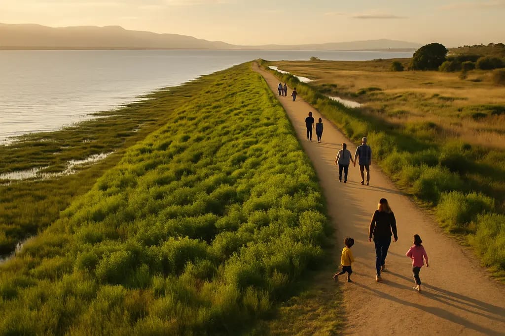
The horizontal levee pilot project at Harbor Marsh in the Palo Alto Baylands has moved from construction to evaluation, after the City of Palo Alto marked completion on September 10, 2026, with a ribbon-cutting and community trail walk, according to the city’s project event notice. The change matters locally because the site sits next to the Regional Water Quality Control Plant and Byxbee Park, linking wastewater reuse, shoreline protection, habitat restoration and public access in one small but closely watched Baylands project.
What The Horizontal Levee Changed
Horizontal Levee Facts For Residents
The project is a 500-foot-long, gently sloped shoreline feature on Harbor Marsh. It covers about 0.7 acres and uses treated effluent from the regional plant to irrigate native plants on the levee slope. Construction began on September 8, 2025, and the city reported an estimated project cost of about $4.6 million in its completion announcement, shared through the City of Palo Alto notice.
The horizontal levee is not being presented by the city as a finished answer to every Baylands flood or habitat question. It is a pilot project, which means its civic value depends on what monitoring shows after construction. The official research notes identify several measures that will be tracked, including soil buildup on the slope, vegetation succession, habitat suitability and comparisons with traditional levees.
Where The Project Sits
The location is important for residents who use the Baylands trails and for agencies watching how shorelines respond to sea level rise. Harbor Marsh is next to the Regional Water Quality Control Plant and Byxbee Park, placing the pilot near both public infrastructure and public open space. Treated water was first sent to the site for testing and startup in 2026, with the research notes identifying August 20, 2026, as the initial flow date and September 8, 2026, as a testing/startup milestone.
The regional plant handles 20 million gallons per day of sewage from about 236,000 residents and businesses, according to the research provided for this report. At this site, treated effluent is reused to support native vegetation on the slope. That connection gives the project a practical civic purpose: it tests whether infrastructure already serving the region can also support Baylands habitat goals.
How The Project Supports Baylands Ecology
Native Planting And Habitat Goals
More than 2,000 native plants representing 35 species were planted as part of the pilot, with seeds from hundreds of native plants also spread. The habitat targets include transitional marsh, wet meadow, riparian scrub and upland habitats. These zones are described in the research as part of an ecotone, the transition between freshwater marshes, wet meadows, upland scrub and tidal marsh.
This horizontal levee was built to restore a kind of transition zone that has become rare because of development. For Palo Alto residents, the ecological importance is not just the number of plants installed. It is the attempt to reconnect habitat types that sit between the Bay edge and drier upland areas. Those transition zones can provide room for wildlife during high tides while also allowing plant communities to establish across a slope rather than along a hard edge.
Wildlife Named In The Project Goals
The research notes identify two endangered species expected to benefit: the salt marsh harvest mouse and the California Ridgway’s rail. The project is intended to provide habitat, foraging areas, nesting areas and refuge from high tides. Those benefits have not yet been reported as measured outcomes in the research provided. They are goals that monitoring is expected to test over time.
For local ecology, that distinction matters. A completed construction project is different from a proven ecological outcome. As of September 19, 2026, the supported facts show that the site has been built, planted and connected to treated-water irrigation. The next public question is how well the plants establish, how wildlife uses the site and whether the slope performs as intended when compared with standard levee designs.
Monitoring, Public Access And Civic Follow-Up

Research Still To Be Reported
Because the horizontal levee is a pilot, the monitoring phase is central. The research notes name USGS, CSU Channel Islands, UC Davis and local nonprofits as participating in ecological monitoring and research. The work is expected to look at soil buildup related to sea level rise, plant succession, habitat suitability and how the design compares with more traditional levees.
Those monitoring topics should be useful to Palo Alto residents and regional agencies for a simple reason: they connect environmental goals with public works decisions. If the site shows that treated-water irrigation and native planting can help build habitat and shoreline resilience, the findings could inform future local or regional projects. If the results are mixed, that information will also matter because it can guide design changes before similar projects are expanded elsewhere.
What Residents Can Watch Next
The city’s September 10, 2026, completion event included a community trail walk, tying the project to public awareness as well as agency work. Residents who use Byxbee Park and nearby Baylands trails may notice the site as part of the shoreline setting, but the research provided does not include new trail rules, access changes or operating hours tied to the pilot. Any future public access changes should be checked through City of Palo Alto notices.
- Watch for city updates on plant establishment and habitat monitoring.
- Look for future reports on treated-water irrigation performance at the site.
- Track whether monitoring compares the pilot’s shoreline function with traditional levees.
- Review public notices before assuming any change in Baylands trail access.
For readers who are interested in public infrastructure projects across the community, One United Michigan features related coverage within the same network. In Palo Alto, the key civic step is to keep the project in public view after the ribbon-cutting, since the ecological findings will take time and should be tied to clear updates from the city or partner researchers.
Palo Alto Horizontal Levee Pilot Project
Why The Completion Date Matters
The September 10, 2026, completion date closes the construction phase and opens the public evaluation phase. The city has described the project as the Bay Area’s first horizontal, or “living,” levee using treated wastewater to irrigate native plants along a gently sloping shoreline facing the Bay. That first-of-its-kind status in the region makes the local monitoring especially relevant for nearby communities with shoreline infrastructure, wastewater facilities and habitat concerns.
The horizontal levee gives Palo Alto a defined test site rather than only a concept. It brings together a 500-foot shoreline slope, native planting, treated effluent reuse and habitat goals for endangered species in one place. The public record now needs to show how those parts perform through monitoring, especially during high tides, plant establishment and longer-term soil development.
What Is Known And What Is Not Yet Known
What is known is specific: construction began on September 8, 2025; the project cost is about $4.6 million; treated water began flowing for startup in 2026; and the city marked completion on September 10, 2026. The research also supports the planting totals, habitat types and wildlife goals listed above.
What is not yet known from the provided public materials is just as important for civic reporting. The research does not include measured survival rates for the native plants, confirmed wildlife use after completion, quantified water quality outcomes or a formal comparison showing how the site has performed against a traditional levee. Those findings should come from future monitoring. Until then, Palo Alto’s completed pilot stands as a public infrastructure and ecology test whose value will depend on transparent reporting and continued local attention.
Leave a Reply