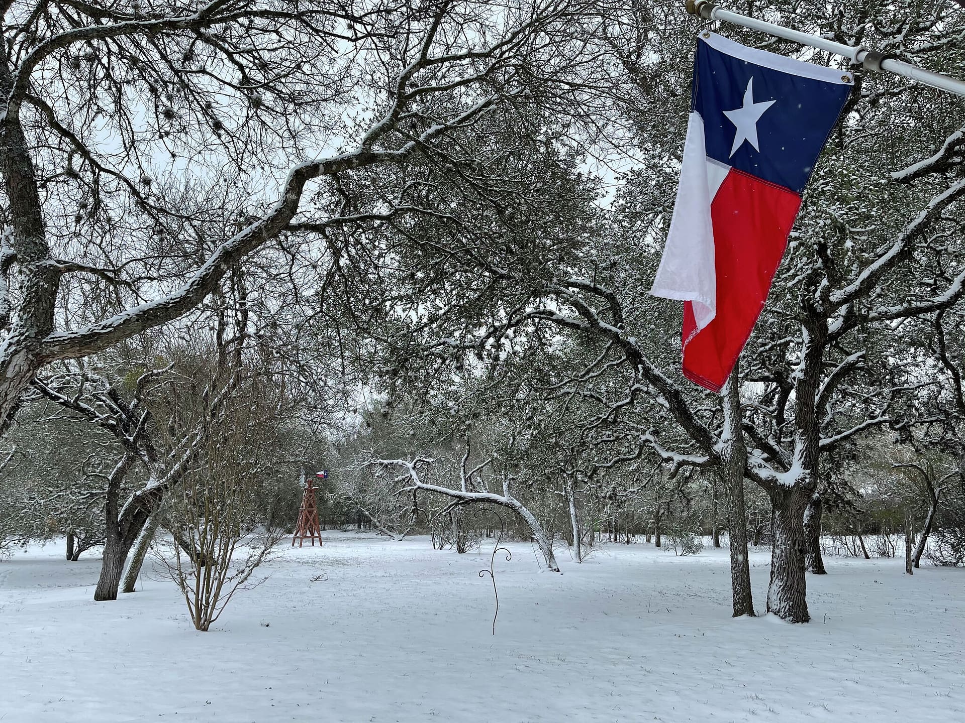
Winter in Trinity County rarely looks like a postcard. Most days are gray and damp rather than white and fluffy. But when cold air lines up just right, our weather can flip from steady rain to sleet or even a brief burst of snow. Understanding the difference matters for school mornings, commutes over bridges, and knowing when to wrap pipes or reschedule plans. Here’s a clear guide to what we get, why we get it, and what local alerts really mean.
What Usually Falls From the Sky Here
Cold rain is our baseline. In East Texas, winter highs typically range from the 50s to low 60s, with nighttime lows in the 30s and 40s. That puts us on the warm edge of most winter systems. The air just above the ground is often too mild to support snow all the way down, so rain wins most battles.
Sleet is the next step colder. Think of sleet as tiny ice pellets. Snowflakes melt as they pass through a shallow layer of warmer air aloft, then refreeze before they hit the ground. You’ll hear it ping on windshields and porches. Roads can turn slick quickly, especially after dark.
Freezing rain is the one that causes the biggest trouble. Raindrops fall through a deep warm layer aloft, then enter a shallow subfreezing layer right at the surface. They don’t have time to refreeze until they land—on roads, bridges, trees, lines—forming glaze ice. It looks harmless at first, but it’s the fastest way to shut down overpasses and the surest path to power outages if ice accretion piles up.
Snow is the least common in Trinity County, but it does happen. When the whole column of air—from cloud to ground—stays below freezing, flakes survive the trip. It’s fleeting, and it often mixes with sleet, but the right setup can coat lawns and fields for a morning, as many remember from the February 2021 outbreak.
Why One Town Gets Sleet and Another Gets Rain
Winter precipitation type comes down to temperature layers above our heads. Forecasters look at a “slice” of the atmosphere to find the so‑called warm nose—a layer of air aloft just above 32°F. If that warm layer is deep, snow melts into raindrops. If the shallow cold layer at the ground is thin, those raindrops glaze on contact as freezing rain. If the cold layer is deeper, drops refreeze before reaching the ground as sleet. Nudge either layer up or down by a few hundred feet, and the whole outcome changes.
That’s why you might see rain in Trinity, sleet in Groveton, and snow mixing near the Houston County line during the same storm. Elevation, distance from the Gulf, and the exact timing of a front all play a role.
What NWS Alerts Mean for Trinity County
The National Weather Service office in Houston/Galveston sets winter alert thresholds tailored to our area. For Trinity County, their criteria are specific and worth bookmarking. According to NWS Houston/Galveston:
- “For … Trinity counties: Potential for 2+ inches of snow and/or ½ inch of sleet and/or 1/8 inch of ice accretion from freezing rain” can trigger a Winter Storm Watch. When those impacts become likely, a Warning follows.
- A Winter Weather Advisory here means “less than 2 inches of snow, less than ½ inch of sleet, [or] less than 1/8 inch of ice … or any combination is expected.” In other words, travel may be difficult even if totals aren’t headline‑grabbing.
- An Ice Storm Warning is reserved for “greater than 1/4 inch of ice accretion due to freezing rain,” when power lines and tree limbs are at risk.
The NWS also issues Freeze Watches and Warnings for the first freeze events of the season, and “Cold Weather Advisory” or “Extreme Cold” products when wind chills meet thresholds. You can read the full criteria at weather.gov/hgx/WWA_criteria.
The Ground Truth: Roads, Bridges, and Black Ice
In our county, bridges and overpasses are the first to ice over. They’re surrounded by air, so they cool faster than roadways built on soil. A shallow subfreezing layer can leave main lanes wet and overpasses slick at the same time. That’s when black ice—the nearly invisible, glassy glaze—becomes the main hazard, especially in the hours just before sunrise.
The second key is ground temperature. After a mild spell, even a hard freeze can take time to chill pavement. That’s why a daytime sleet shower may bounce and melt, while the same shower at 3 a.m. sticks instantly. Wet‑bulb temperature—how cold the air gets as raindrops evaporate—also matters. Dry air ahead of a front can drop the wet‑bulb quickly, flashing wet roads to ice as the front arrives. Forecasters watch these details closely on winter nights.
What To Watch For in the Forecast
Front Timing
Most winter mix events here follow a strong arctic front. If the front races in overnight and temperatures free‑fall while precipitation lingers, that’s the classic sleet/freezing rain setup. If dry air surges in too quickly behind the front, the moisture may shut off and you’ll just get cold and dry.
“Warm Nose” Talk
When you read the forecast discussion and see mention of a “warm nose aloft,” think freezing rain or sleet potential. No warm nose at all, and snow is more likely—though we still need enough deep moisture and lift to make flakes.
Advisory vs. Warning Language
An Advisory means slower travel, not a shut‑in day. A Warning means more significant icing or accumulating snow that could impact power and roads. If you see “Ice Storm Warning,” plan on staying put and charge your devices.
How Often Do We See the Wintry Stuff?
Climatologically, Trinity County sees several freezes each winter and a handful of mornings in the 20s. Sleet is more common than snow, and freezing rain is the most disruptive when it occurs. Big, county‑wide snowfalls are rare, but mixed events on the north side of the county are not unusual in colder years. The February 2021 event was a high‑impact outlier for our region, with the National Weather Service documenting record cold and a mixture of snow and ice across Southeast Texas. Most years, our winter hazards are quieter but sneaky: patchy glaze on bridges, freezing drizzle after dark, and hard freezes after soaking rains.
Preparation That Fits Our Winters
We learn the same lessons every few years. Pipes that are fine at 31°F can split at 19°F, especially after several subfreezing hours. Outdoor faucets and any exposed pipes need insulation. Pets and plants need a plan. Generators must be run outdoors, away from doors and windows; carbon monoxide has no smell and kills quietly. Space heaters should sit on the floor, away from curtains and bedding, and never run unattended. Vehicles need enough fuel, a blanket, and a phone charger if you must drive.
If freezing rain is in the forecast, get your errands and refueling done early. If the call is sleet and snow, plan a later start to let crews treat bridges. Most winter episodes here last a day or two; having a small stock of non‑perishables and batteries is enough for most households.
Local Resources That Help
The National Weather Service Houston/Galveston office updates forecasts and discussions several times a day. Their social feeds and the briefing page flag when winter hazards are on the table. NOAA Weather Radio can wake you if warnings are issued overnight. The Trinity River Authority posts lake and river data; if ice or power issues arise near Lake Livingston, those updates can be helpful. County emergency management and TxDOT road condition maps offer real‑time views of closures and travel impacts.
The Bottom Line for Trinity County
Most winter days here are all jacket and no drama. But our biggest headaches happen when the shallow, near‑freezing air at the surface battles a warmer layer aloft. That’s when bridges glaze fast, limbs bend, and a simple commute turns risky. Read the forecast with those layers in mind, take NWS advisories seriously, and keep your plans flexible on the coldest mornings.
As the NWS explains in its local criteria, Trinity County moves from Advisory to Warning when snow, sleet, or ice reach thresholds that threaten life and property. That clear line helps schools, road crews, and families decide when to pause and when to push through. With a little preparation—and an eye on those overnight temperatures—you can turn winter’s guesswork into a manageable plan, whether the day brings snow, sleet, or just plain cold rain.
Leave a Reply